Llangollen Canal
The Llangollen Canal is one of the most picturesque and beautiful canals in Britain, and hence is very popular.
Map of the Llangollen Canal

The above map shows the route of the Llangollen Canal. It starts just north of Nantwich, where it leaves the Shropshire Union Canal. The route then travels through rural Cheshire and Shropshire farmlands to cross the border into Wales near Chirk. It then cuts through increasingly hilly country-side via tunnels and the Pontcysyllte Aqueduct to arrive at Llangollen. The Llangollen canal is 41 miles long, and it typically takes 3 to 4 days to cruise each way.
What makes the Llangollen Canal popular is the stunning scenery and engineering feats used to construct it. The scenery is very varied from farmland and sheep pastures, to ancient peat mosses, tree lined lakes around Ellesmere, and the foothills of Snowdonia at Llangollen. The canal passes through various towns including:
The medieval town of Whitchurch with its half-timbered buildings.
The interesting market town of Ellesmere with various lakes dotted around it.
The fortified border town of Chirk with its National Trust Castle and beautiful gardens.
Finally Llangollen itself, sat astride the River Dee, beneath the ruins of Castel Dinas Bran, and the hills of Snowdonia in the background.
The amazing engineering feats along the Llangollen canal include tunnels at Ellesmere, Chirk, and Whitehouse, plus the Chirk and Pontcysyllte Aqueducts. It is these Aqueducts that are truly spectacular and were built by engineers Thomas Telford and William Jessop that were among the first to use cast iron troughs to contain the canal.
The Pontcysyllte Aqueduct is a UNESCO World Heritage Site. The cast iron trough carrying the canal sits high above the River Dee, and is supported by elegant masonry aches. It spans the River Dee for 1,000ft at a height of 126ft providing spectacular views, and is a truly great architectural and en-gineering feat.

The Pontcysyllte Aqueduct near Llangollen
What maps and Guidebooks are available for the Llangollen Canal?
The Heron Llangollen and Montgomery Canals Map provides detailed information for both water-ways and leisure users at a scale of 1:56,000.
The Welsh Waters Pearson Canal Companion details the Llangollen Canal along with other Welsh canals and the Shropshire Union Canal. The Welsh Waters Pearson Canal Companion uses large scale maps and diagrams along with detailed descriptions of the canal, plus information on water-side towns and villages, listings on eating and drinking, shopping, visitor centres, public transport and boating facilities.
The Nicholson Waterway Guide 4: Four Counties and Welsh Canals also details the Llangollen Canal plus 8 other canals in Wales and England. Using OS mapping it shows locks, bridges, tunnels, aqueducts, boatyards, pubs, restaurants and local shops.
Llangollen Canal Photographs
The following photographs appear in the Welsh Waters Pearson Companion that is available to buy from our shop.
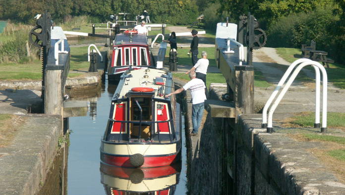
Hurleston Locks. The four closely spaced locks at Hurleston are at the start of the Llangollen Canal. This photograph is © Pearson Companions.
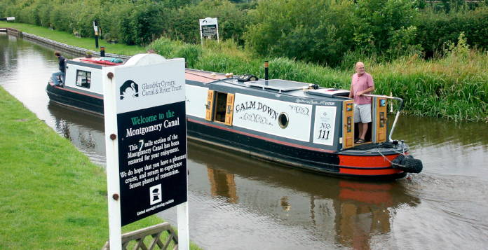
The photograph shows Frankton Junction, where the Montgomery Canal starts. This photograph is © Pearson Companions.
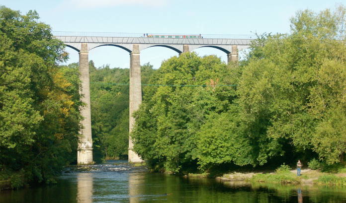
The photograph shows Pontcysyllte Aqueduct, the ultimate “Stream in the Sky”. This photograph is © Pearson Companions.
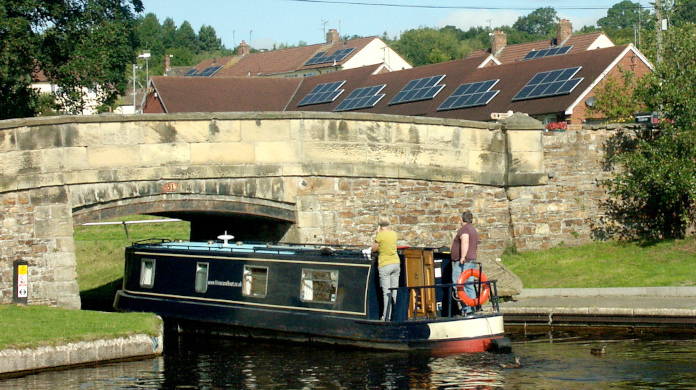
The photograph shows the Trevor Basin section of the Llangollen Canal. This photograph is © Pearson Companions.